
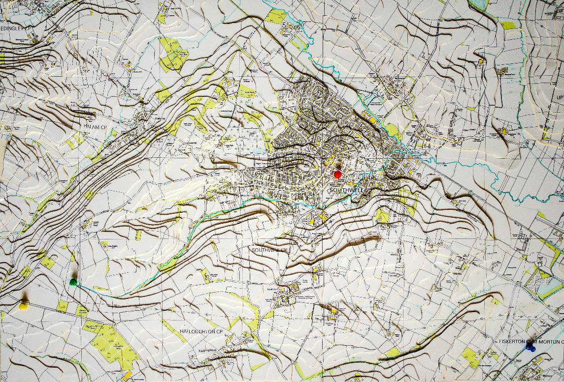
This 3D map created by Kath and Andy Wimble shows just how Southwell sits in a valley with the dumbles that flow into the main water-course – the Potwell Dyke. It also shows the secondary water-courses which flow from Halam Hill and Norwood Park.
Photographed by Chris Knapton, Richfield Industrial
In an interview with the Newark Advertiser, Mrs Katy Todd, a member of Southwell Flood Forum, said because the town had flooded more than once it was important to understand the causes.
“The map helps us understand exactly what happened.
“Some of us have walked the watercourse right up to where it starts up near Oxton and I was surprised at just how deep the Dumbles are.
“When it rains heavily or we have a lot of rain over a long period of time the water flows into the Dumbles, which acts as a big drain and brings the water into the town.
“The rain was exceptionally heavy in July. It was not the first time the town has flooded but it was the worst.”
Understanding the issues will help the town to find solutions to the problems.It shows everybody what we are dealing with and how we might resolve the situation.
Southwell Flood Forum will hold a public meeting in Southwell Minster on Tuesday, September 10, at 7pm.
The meeting will be a chance for residents to learn about the flood forum and how they can help.
There are several groups within the flood forum including the Potwell Dyke group, the group for Halam Hill and others.
We know that just as many houses in the town were flooded by surface water and that is something we are looking into as well. They are distinct problems with distinct solutions.
The meeting is for people who flooded, people who were affected by the flooding and particularly people whose properyt backs on the watercourses.